Join us for a free one-day workshop for educators at the Japanese American National Museum, hosted by the USC U.S.-China Institute and the National Consortium for Teaching about Asia. This workshop will include a guided tour of the beloved exhibition Common Ground: The Heart of Community, slated to close permanently in January 2025. Following the tour, learn strategies for engaging students in the primary source artifacts, images, and documents found in JANM’s vast collection and discover classroom-ready resources to support teaching and learning about the Japanese American experience.
China at the Center: Rare Ricci and Verbiest World Maps
The Asian Art Museum presents an exhibition of maps in an exploration of how China was geographically imagined.
When:
March 4, 2016 10:00am to May 8, 2016 5:00pm
Where
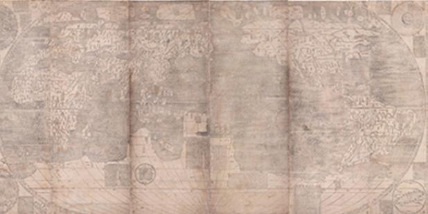
Travel back in time more than 400 years to an era when the globe was being mapped and its wonders discovered.
The Asian Art Museum presents two rare masterpieces of 17th-century cartography, the result of early collaborations between Jesuit priests and Chinese scholars sharing knowledge and curiosity about the world. The 1602 Ricci map, developed by Matteo Ricci while in China, is the earliest known Chinese map to depict the Americas. The 1674 Verbiest world map, created by Ferdinand Verbiest for the Chinese court, is being exhibited for the first time ever.
Through these large-scale woodblock-printed maps, discover how much of the world’s geography and ethnography was known at this early date, including the longest river in Africa, the peninsula of Florida, the fish-skin clothing of the far north and the feathered garb of Amazonian peoples. Two interactive digital displays reveal translations describing the peripheries of the “known world”: lands where giants paint their faces, oceans with mermaids and flying fish, and a kingdom inhabited by foot-tall humans who live in constant fear of being devoured by hawks.
With easy access to GPS technology, the world is now literally at our fingertips. These maps transport us to an age when tremendous effort was required to understand the contours of the world and to record (and imagine) the marvels within it.
Event Website URL:
Phone Number:
415.581.3500
Featured Articles
October 20, 2024
October 20, 2024
Please join us for the Grad Mixer! Hosted by USC Annenberg Office of International Affairs, Enjoy food, drink and conversation with fellow students across USC Annenberg. Graduate students from any field are welcome to join, so it is a great opportunity to meet fellow students with IR/foreign policy-related research topics and interests.
RSVP link: https://forms.gle/1zer188RE9dCS6Ho6
Events
Wednesday, November 20, 2024 - 3:00pm
Hosted by USC Annenberg Office of International Affairs, enjoy food, drink and conversation with fellow international students.
Thursday, November 7, 2024 - 4:00pm
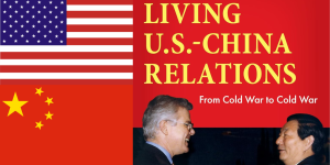
Join us for an in-person conversation on Thursday, November 7th at 4pm with author David M. Lampton as he discusses his new book, Living U.S.-China Relations: From Cold War to Cold War. The book examines the history of U.S.-China relations across eight U.S. presidential administrations.